
Photos Submitted for Appraisal
🔍 Click to enlarge and inspect marks, signatures, and condition detailsTap to zoom and inspect details
What Is a Antique Surveyor's Map of Longview Subdivision in the District of Columbia Worth?
Based on 86,000+ real collector appraisals
✓ 3 comparable items analyzed
✓ Historical records for 1880 to 1910 items reviewed
Have a similar item? Find out what it's worth.
See What Your Item Is Worth →Free • Takes about 2 minutes
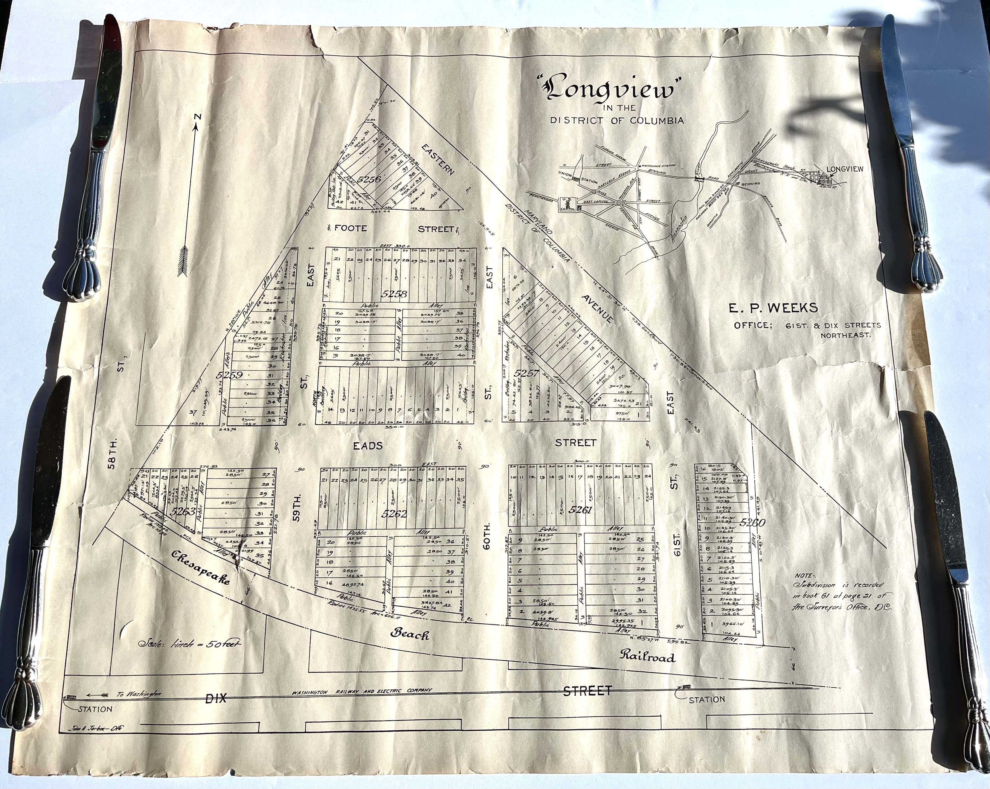
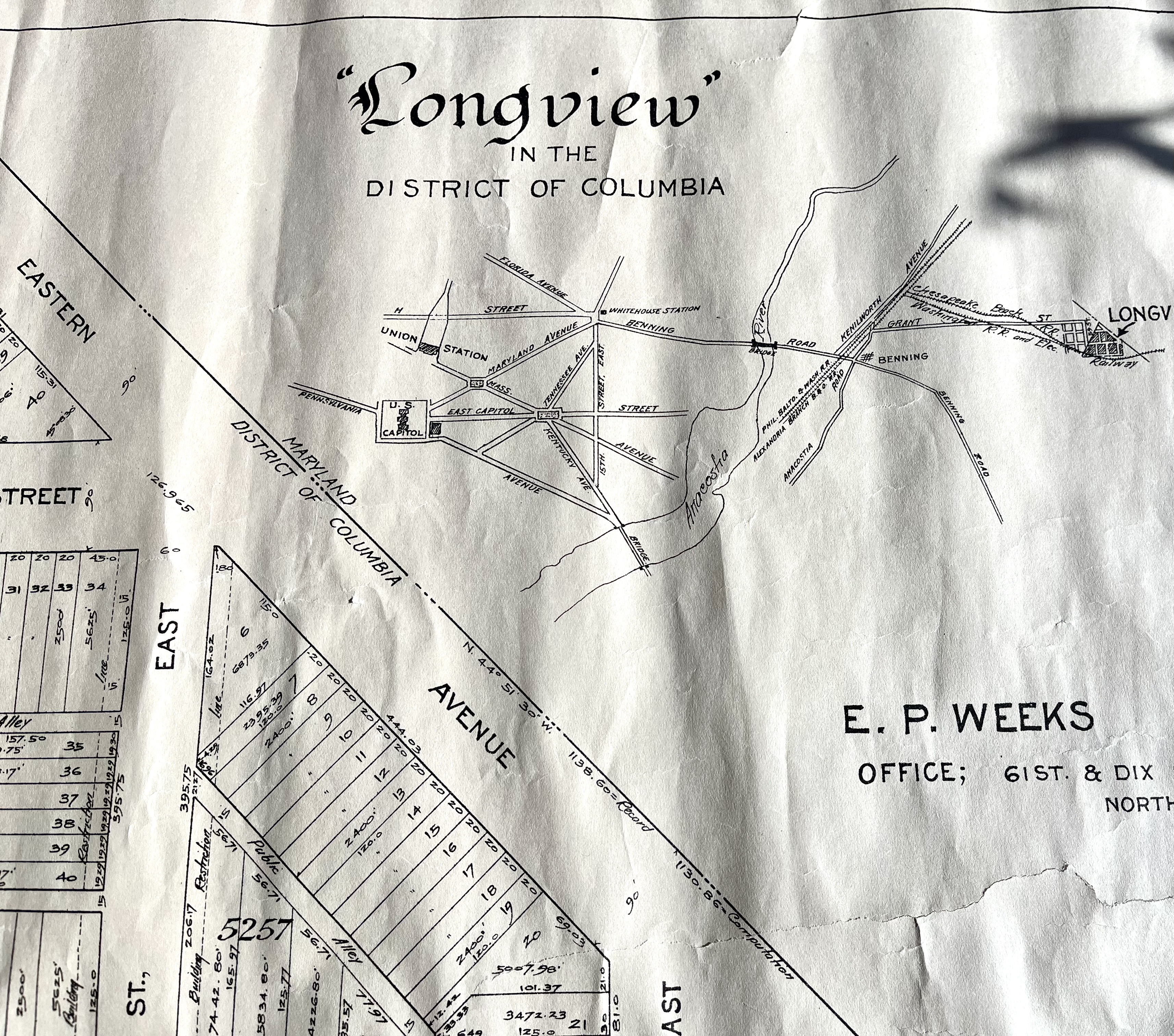
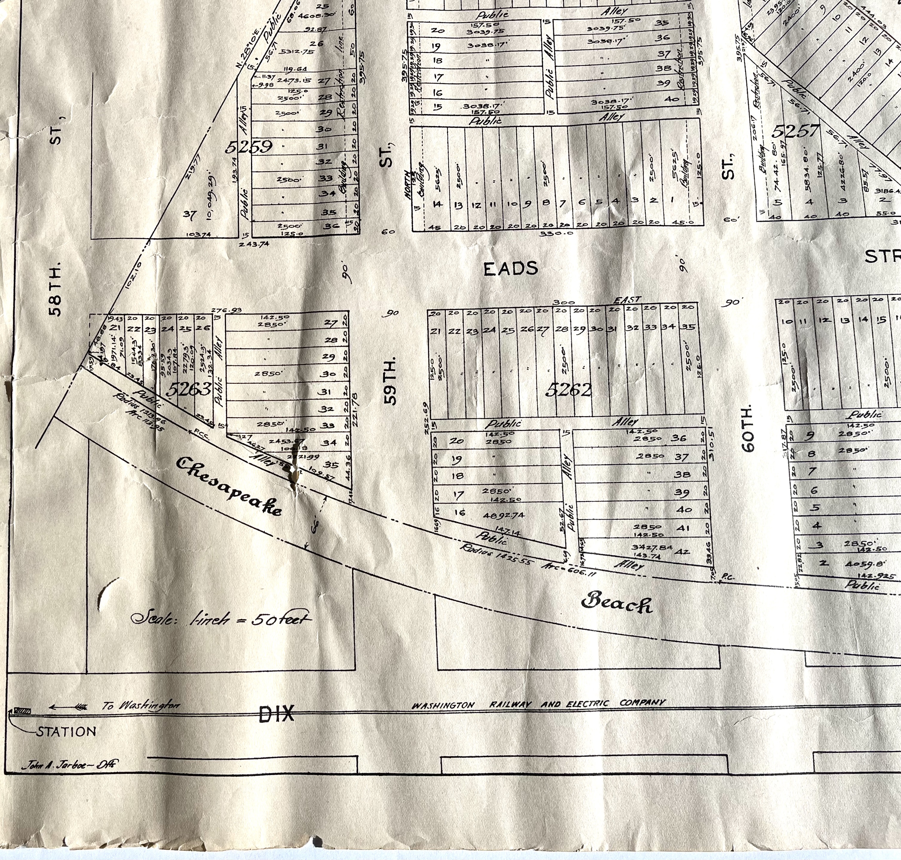
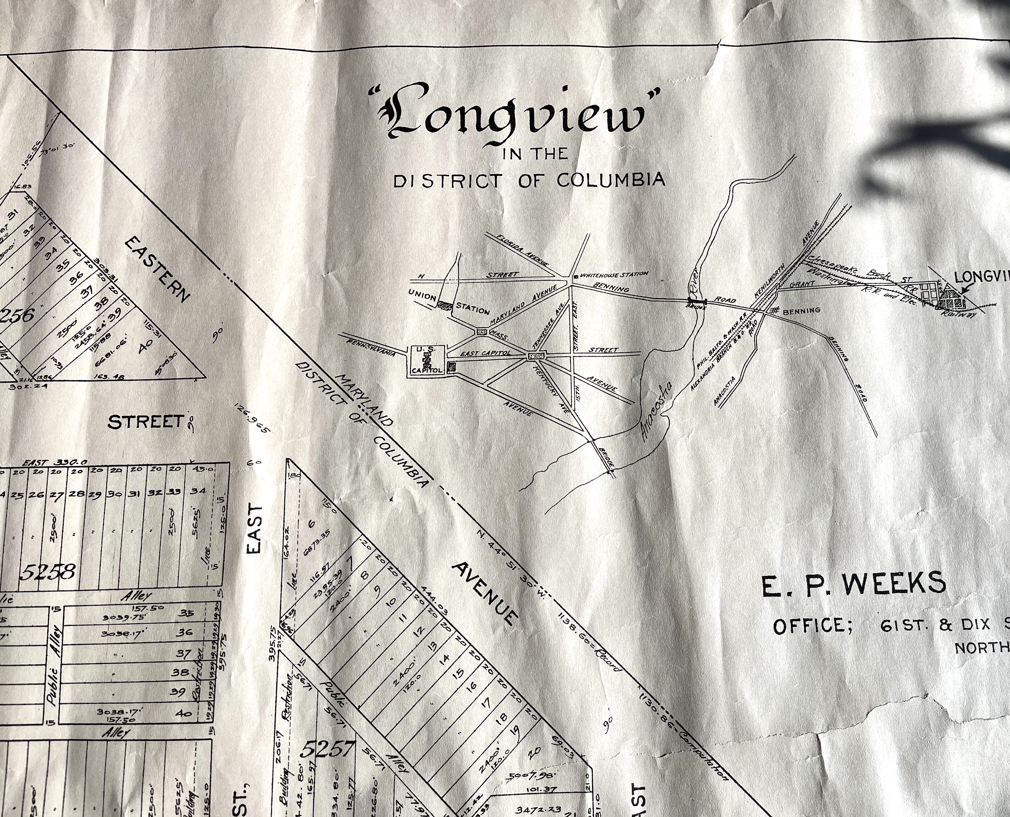
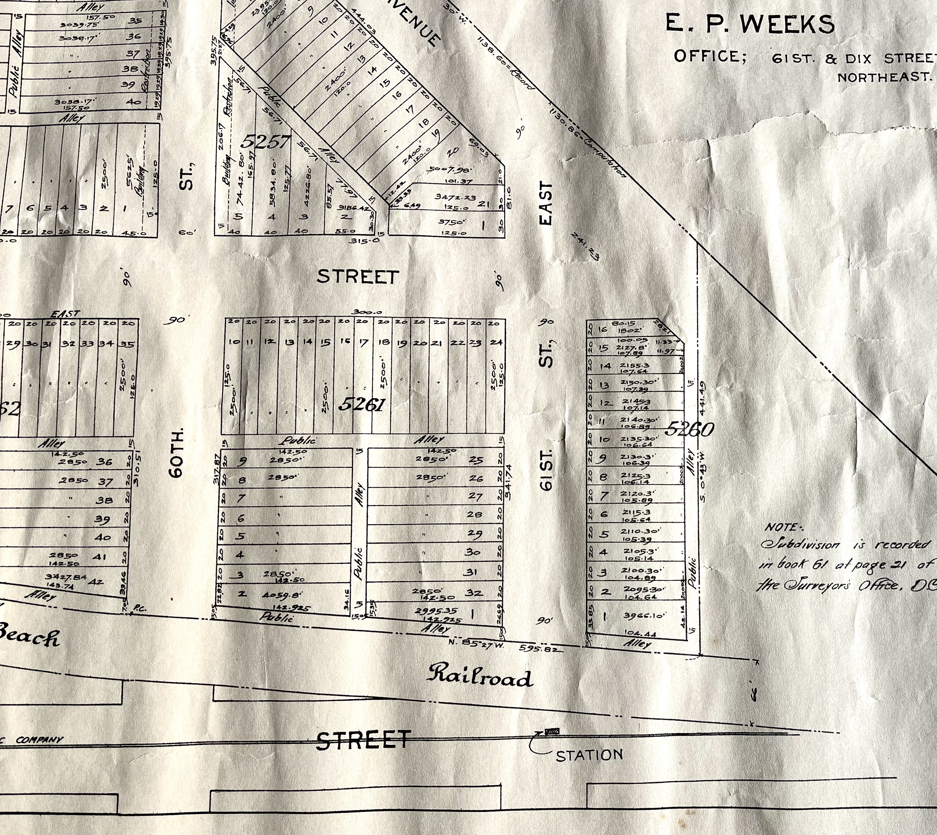
This is an antique map of an area in Washington D.C. While the condition has aged it could be framed by a professional. A special restoration tape was applied to the back for the few tears.
Upgrade for PDF reports, more daily appraisals, and ad-free experience.
Community Reactions
Collector Discussion
Do you recognize this piece? Collectors often identify maker marks, share comparable sales, or suggest additional research steps.
The AI dates this piece to 1880 to 1910. Does this match what you've seen for similar items? Share your expertise below.
Share your knowledge about this item
Be the first collector to share insight
Collectors often share maker marks, history, and comparable sales.
AI Appraisal: Antique Surveyor's Map of Longview Subdivision ...
💰 Estimated Value
Value estimate available
Confidence: 85%
Unlock the Full Appraisal
See detailed pricing logic, comparable sales, market context, and selling advice.
Create Free Account
Already have an account? Log in
Already submitted this? Check your email for access link.
📋 Maker Identification — Signature analysis and attribution...
📊 Market Context — Current demand and collector interest...
🏷️ Comparable Sales — Recent auction results and prices...
💡 Selling Strategy — Best venues and timing...