


Click any image to enlarge
AI Appraisal
Description
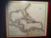
a rolled map of the British Isles engraved by W. & A.K. Johnston Limited.Edinburgh and London. I cannot find a date but am pretty sure it is from the last half of the 19th century.
The scale is 14 miles to the inch, shows cathedrals, battle sites, steamship rtes( British end) with estimated time of passage eg, new york 7 days, Quebec 8 days, Copenhagen 54 hrs etc.
The map is in very good condition. I have found maps from this cartographer/ engravers dating 1854 and 1861 but not this exact version.
Category
Maps, Charts, and Nautical
Medium
clothlike paper
Distinguishing marks
engravers name, has cathedrals,hist.battlefields,steamship rtes with length of passage eg Copenhagen 54 hrs
Condition
Good
Size and dimensions of this item
approx 40" x 60", is rolled wall map from a one room shoolhouse
Date Period
nineteenth century
Weight
4 lbs
History
purchased at an estate auction around 1995
eBay Auction Link
Price Paid (If known)
$0.50
⚠️ You have 1 free appraisal left today
Upgrade for 15-30/day →
Want more from your appraisals?
View Plans →
Upgrade for PDF reports, more daily appraisals, and ad-free experience.