Home

Main navigation

  • Free Appraisals
    • Get a Free Appraisal
    • View Appraisals
    • Local Appraisers
  • Classifieds
  • Blog
  • Shows
    • Antique Shows, Flea Markets, & Swap Meets Map
    • Upcoming Shows
User Menu
  • Login
  • Help
  • Register

Breadcrumb

  1. Home

Hurricane Plotting Map

By KXOM, 27 April, 2010
Description

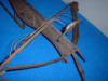
Metal eched of The Gulf Coast,Florida, Atlantic Coast, Bermudas, Bahamas, And Caribean Area. Shows Longitude and Latitude.

Category
Maps, Charts, and Nautical
Medium
metal
Distinguishing marks
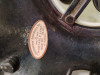
Reid's Mapping Service
Condition
Good
Size and dimensions of this item
21.5"x13.5"
Date Period
1956
Weight
3-5 lbs.
eBay Auction Link
For Sale?
No
  • Log in or register to post comments

Recent Appraisal Comments

  • Antique Art Nouveau Ceramic Box (Attributed to Carl Sigmund Lube
  • Antique Or Vintage Ceramic Umbrella Stand
  • Any help as to what this may…
  • Painting - Possibly Alfred Fontville De Breanski Jr
  • Has been on the wall of our…
  • Pair of Paul Hanson Hand-Painted Table Lamps
  • Handcrafted Ceramic Tray with Agate Glaze Pattern
  • Hand-Painted Gone with the Wind Hurricane Lamp
  • Blenko Handmade Glass Bowl – Blue with Gold Foot (14.5")
  • Robert Berran Limited Edition Lithograph Set for C.G. Conn Ltd.

© 1995- InstAppraisal™, Inc. All Rights Reserved Worldwide
Privacy Policy, Cookie Policy, Terms and Conditions, End User License Agreement