
Click any image to enlarge
AI Appraisal
Description
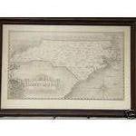
This is the map. There is some fade to it. But it appears to be a print by Karl Smith dated 1934.
Category
Maps, Charts, and Nautical
Medium
It's in an old black frame.
Condition
Good
Date Period
1934
⚠️ You have 1 free appraisal left today
Upgrade for 15-30/day →
Want more from your appraisals?
View Plans →
Upgrade for PDF reports, more daily appraisals, and ad-free experience.
Collector Discussion
Do you recognize this item or have experience selling something similar? Your insight could help improve the appraisal.
Re: NC map by Karl Smith