
Photos Submitted for Appraisal

🔍 Click to enlarge and inspect marks, signatures, and condition detailsTap to zoom and inspect details
AI Appraisal
Description
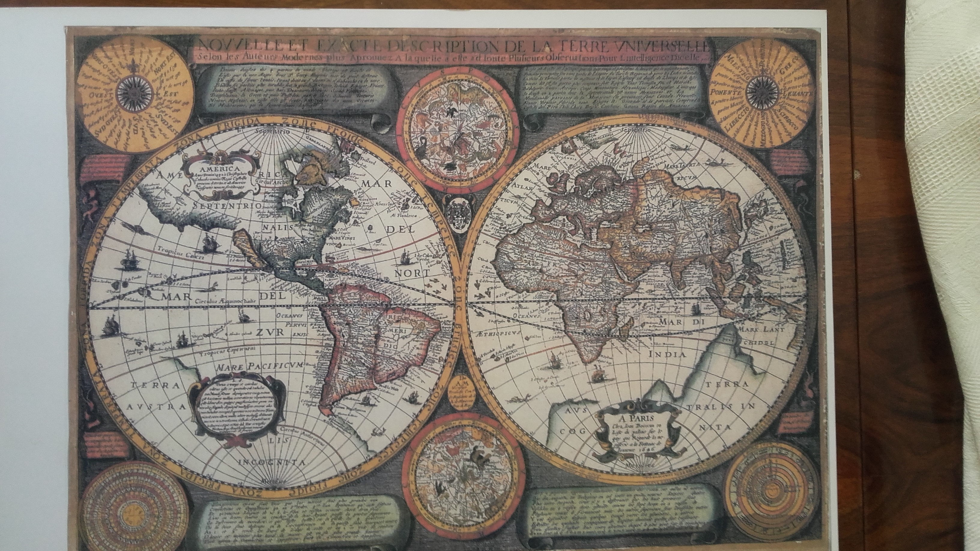
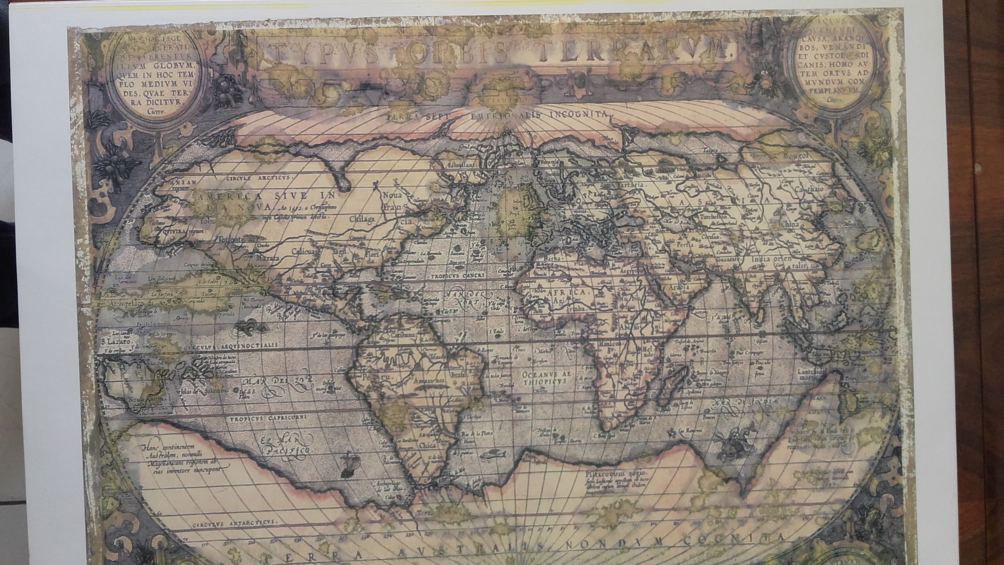
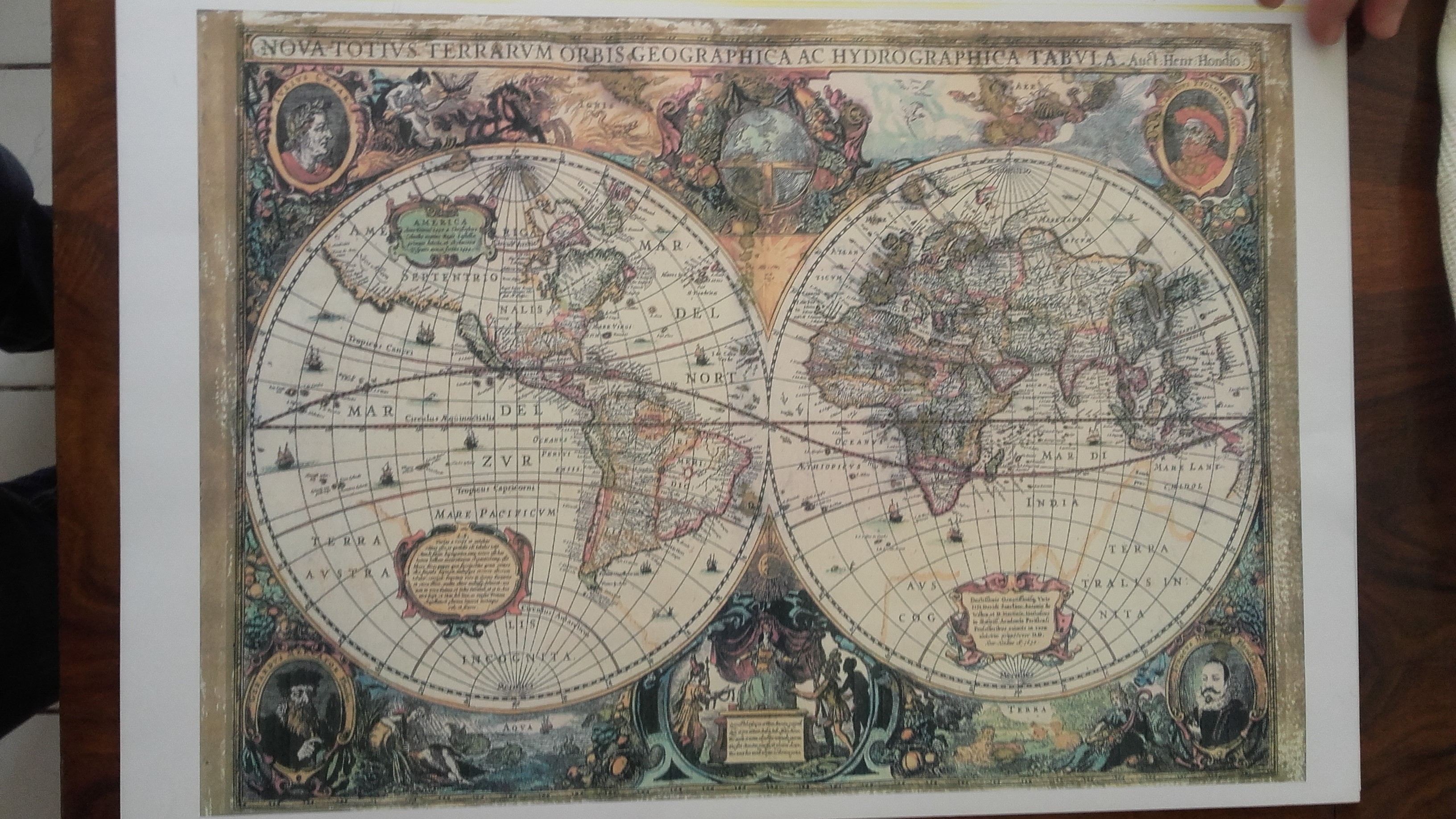
World and Europe old maps, potential 15-16th centuries, "similar' to Nova Totius Terrarum Orbis tabula_(Hendrik_Hondius), Ortelius WorldMap (1570) or "blau" Europe
Category
Maps, Charts, and Nautical
Medium
special paper. carton, etc
Distinguishing marks
N/A
Condition
Good
Date Period
N/A
Collectors with this item
Want to appraise yours? Upload photos for a free appraisal →
⚠️ You have 1 free appraisal left today
Upgrade for 15-30/day →
Want more from your appraisals?
View Plans →
Upgrade for PDF reports, more daily appraisals, and ad-free experience.
Collector Discussion
Do you recognize this piece? Collectors often identify maker marks, share comparable sales, or suggest additional research steps.