
Photos Submitted for Appraisal

🔍 Click to enlarge and inspect marks, signatures, and condition detailsTap to zoom and inspect details
AI Appraisal
Description
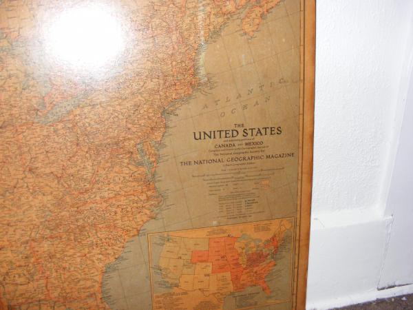
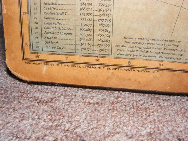
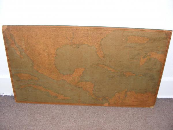
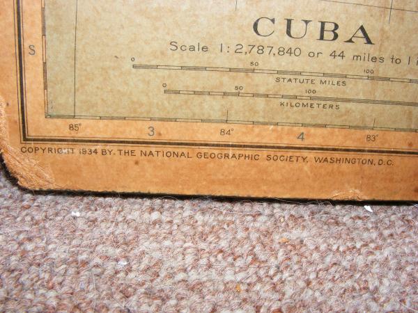
The USA map is slightly taller than the Central America map. There is a lot of damage to the outer sides of the maps, especially to the USA map. But for the most part the totality of the pieces are unmarked. There looks like some small paint splatters on the USA map. As I bought these from a garage sale, they looked to be stored in the garage by their past owners. The Mexico map has an old wire string to hang, but the USA map does not. The Central America map has the copyright listed with 1934 next to it. The USA map has the same copyright but the date is 1940. They do have scratches, dents and marks. They are placed on some sort of wooden board. Perhaps they were once used in a school? I'm not sure. I wanted to find out what they were worth, since I also assume they are worth more than the 50 cents a piece I paid for them.
Category
Maps, Charts, and Nautical
Medium
Board
Distinguishing marks
National Geographic Society
Condition
Good
Size and dimensions of this item
Approx 2 1/2 ft X 4 ft
Date Period
1934
Weight
4 lbs for both
History
I found these two at a garage sale with no other information provided
eBay Auction Link
Price Paid (If known)
50 cents each
Collectors with this item
Want to appraise yours? Upload photos for a free appraisal →
⚠️ You have 1 free appraisal left today
Upgrade for 15-30/day →
Want more from your appraisals?
View Plans →
Upgrade for PDF reports, more daily appraisals, and ad-free experience.
Collector Discussion
Do you recognize this piece? Collectors often identify maker marks, share comparable sales, or suggest additional research steps.