

Click any image to enlarge
AI Appraisal
Description
Not able to tell the material feels like card stock. Printing method unknown.
c.1725?
Category
Maps, Charts, and Nautical
Medium
Not sure. A print it seems. No relief or texture to the surface. About as smooth as cardboard.
Distinguishing marks
Title in bottom right
Condition
Good
Size and dimensions of this item
22"×19"
Date Period
c. 1725 original. This one probably 20th century.
History
Unknown. I've had it for 8 years given to me.
⚠️ You have 1 free appraisal left today
Upgrade for 15-30/day →
Want more from your appraisals?
View Plans →
Upgrade for PDF reports, more daily appraisals, and ad-free experience.
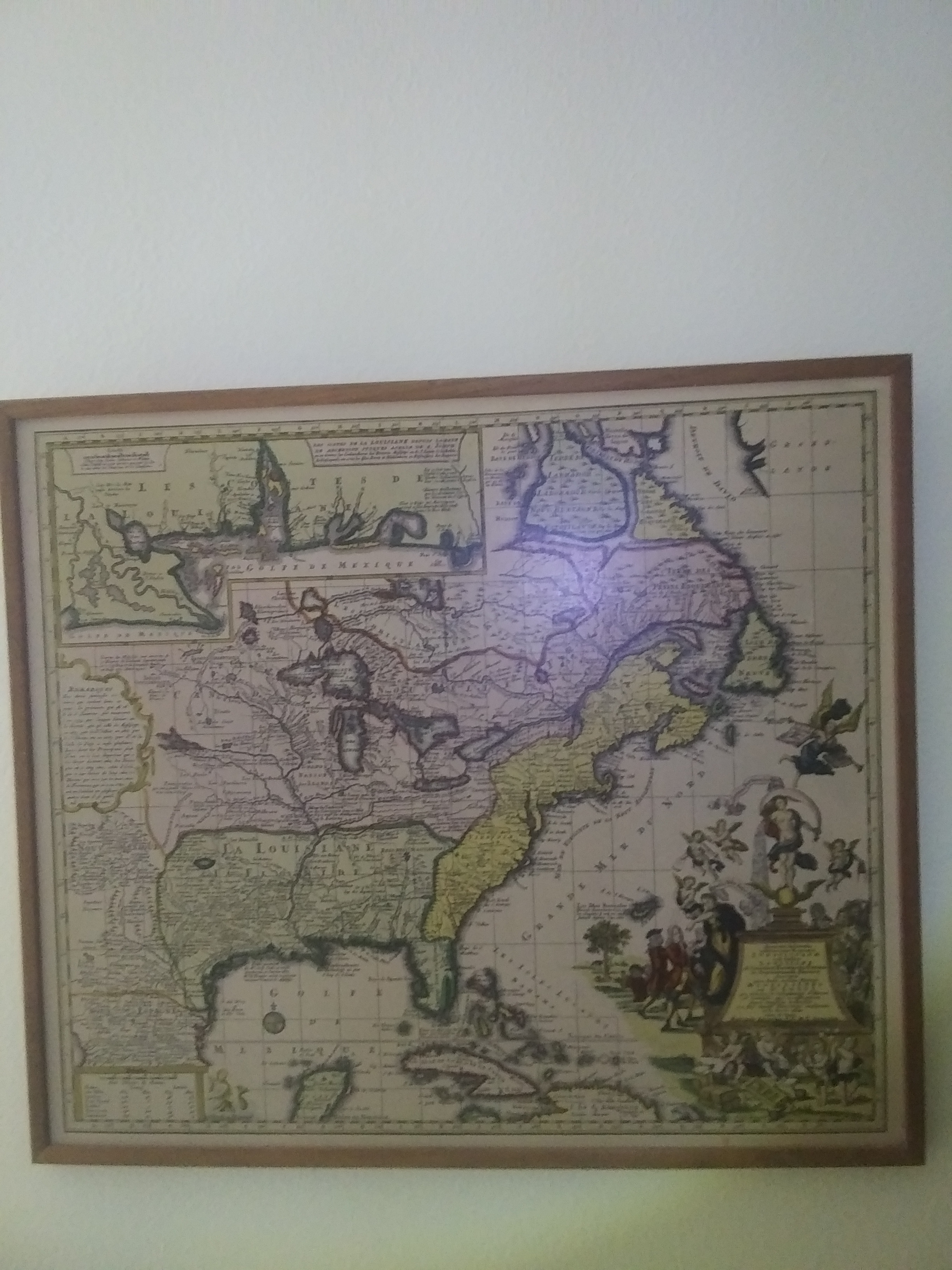
Matthei Seutteri Map
Just trying to find out what the material could be and when would this be produced and value if any.
Framed Reproduction Map of Colonial North America
Item Description & Report
Item: Framed Reproduction Map of Colonial North America
Title: Carte de la Louisiane et du cours du Mississipi
Original Date: Circa 1720–1725
Attribution: Based on design, likely after Guillaume de L’Isle, a prominent French cartographer
Medium: Printed reproduction on smooth, cardstock-like paper
Size: Approximately 22" x 19" (framed)
Condition: Good – no visible tears or water damage; frame is intact; color remains vibrant
Markings: Decorative title cartouche in lower right, consistent with period maps of the early 18th century
Reproduction Date: Most likely 1960s–1990s based on materials and printing quality
Historical Context
The map depicted is a famous and widely reproduced historical map by Guillaume de L’Isle, first published around 1718–1725. This map was one of the first to accurately depict the Mississippi River, the Great Lakes, and French Louisiana territory, and it was foundational in shaping European understanding of North American geography in the 18th century.
Originals of this map are rare and highly collectible, often housed in museums or sold at major auctions.
Current Value Estimate
Because this is a modern reproduction (based on the flat print, paper texture, and framing), it is decorative rather than collectible in the historical sense. However, these reproductions can still have aesthetic and educational value.
Recommendations
If you'd like help identifying whether your map was printed using a special historical process (like photogravure or lithography), close-ups of the surface under light can help—especially if there’s any dot matrix pattern, plate embossing, or publisher mark.